Global Cloud Biases in Optical Satellite Remote of Rivers
Abstract
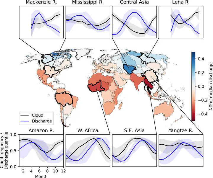
Satellite imagery provides a global perspective for studying river hydrology and water quality, but clouds remain a fundamental limitation of optical sensors. Explicit studies of this problem were limited to specific locations or regions. In this study, we characterize the global severity of this limitation by analyzing 22 years of daily satellite cloud cover data and modeled river discharge for a global sample 21,642 river reaches of diverse sizes and climates. Our results show that the bias in observed river discharge is highly organized in space, particularly affecting Tropical and Arctic rivers. Given the fundamental nature of this cloud limitation, optical satellites will always provide a biased representation of river conditions. We discuss several strategies to mitigate bias, including modeling, data fusion, and temporal averaging, yet these methods introduce their own challenges and uncertainties.